Thursday, 4 January 2018

How much does light weigh?

Does light weigh anything? Well, yes and no.


If there were a simple answer to how much light weighs, we'd all know it. There would probably be some sort of elementary school rhyme to help us remember the exact figure! Instead, we are forced to wade through complicated half-answers that go something like, "Um, it kind of weighs a little, but not like how regular things weigh."

Photons are the smallest measure of light, and no, they don't have mass. So that's easy, right? Light is composed of photons, which have no mass, so therefore light has no mass and can't weigh anything.

Not so fast. Because photons have energy - and, as Einstein taught us, energy is equal to the mass of a body, multiplied by the speed of light squared. How can photons have energy if they have no mass?

Actually, what Einstein was proving is that energy and mass could be the same thing - all energy has some form of mass. Light may not have rest (or invariant) mass - the weight that describes the heft of an object. But because of Einstein's theory (and the fact that light behaves like it has mass, in that it's subject to gravity), we can say that mass and energy exist together. In that case, we'd call it relativistic mass - mass when an object is in motion, as opposed to at rest.

So our answer is a grab bag of yeses and nos. Does light have a mass that can be weighed on the bathroom scale? Most certainly not. But it is a source of gravitational fields, so we could say that a box of light weighs more than a box without light - as long as you're comfortable understanding that the "weight" you're measuring is a form of energy and not, say, pounds or kilograms.

Source - HowStuffWorks.com - How much does light weigh? by Kate Kershner published on 22 September 2014

Tuesday, 2 January 2018

How does Google Maps predict traffic?


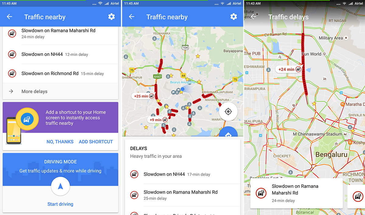
The green, yellow and red routes that Google Maps uses to indicate clear, slow-moving, or heavily congested traffic are a great help when you're trying to determine the fastest way to your destination, but how does Google know the traffic conditions between where you are and where you're trying to go?


Google Maps bases its traffic views and faster-route recommendations on two different kinds of information -
  1. Historical data about the average time it takes to travel a particular section of road at specific times on specific days
  2. Real-time data sent by sensors and smartphones that report how fast cars are moving right then

Early versions of Google Maps relied only on data from traffic sensors, most of which were installed by government transportation agencies or private companies that specialize in compiling traffic data. Using radar, active infrared or laser radar technology, the sensors are able to detect the size and speed of passing vehicles and then wirelessly transmit that information to a server. Data from these sensors can be used to provide real-time traffic updates, and, once collected, the information becomes part of the pool of historical data used to predict traffic volume on future dates. However, sensor data was largely limited to highways and primary roads (that too only in the Western world) because the sensors were typically installed only on the most heavily traveled or traffic-prone routes.

Beginning in 2009, Google turned to crowd-sourcing to improve the accuracy of its traffic predictions. When Android phone users turn on their Google Maps app with GPS location enabled, the phone sends back bits of data, anonymously, to Google that let the company know how fast their cars are moving. Google Maps continuously combines the data coming in from all the cars on the road and sends it back by way of those colored lines on the traffic layers.

As more and more drivers use the app, the traffic predictions become more reliable because Google Maps can look at the average speed of cars traveling along the same route (without misinterpreting someone's morning coffee stop as a traffic jam). If Google Maps doesn't have enough data to estimate the traffic flow for a particular section of road, that section will appear in gray on the traffic layer.

Google added a human element to its traffic calculations with its acquisition of Waze. Drivers use the Waze app to report traffic incidents including accidents, disabled vehicles, slowdowns and even speed traps. These real-time reports appear as individual points on Google Maps, with small icons representing things like construction signs, crashed cars or speed cameras.


Source - HowStuffWorks.com - How does Google Maps predict traffic? by Beth Brindle published on 31 October 2014